For directions to the Pre-Conference Institute venue, please see here.
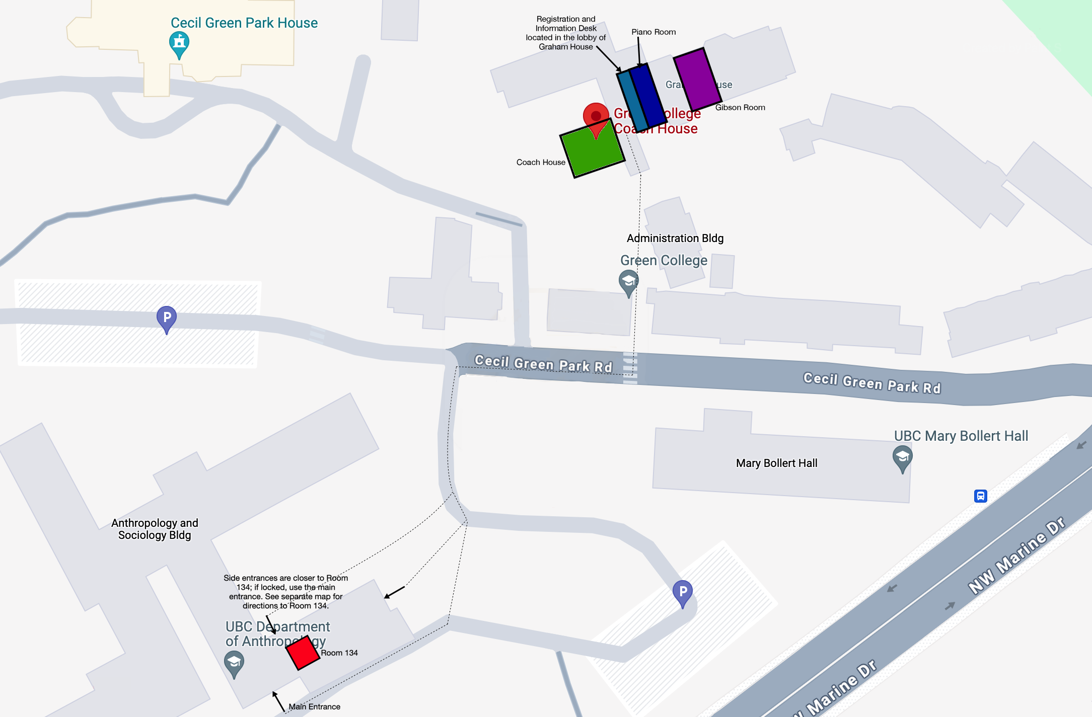
The Conference will take place at Green College Coach House and Graham House; some talks will be held in the nearby Anthropology-Sociology building. Click map for an enlarged image.
The closest bus stop to Green College is serviced by route 68, which leaves the Bus Exchange from Bay 1 every 20-30 minutes. Its route takes approximately 5 minutes from Bay 1 to the “WB NW Marine Dr @ Cecil Green” stop, which will be the first stop on the route. To return to the bus loop from Green College, board the 68 toward UBC Bus Exchange at the “EB NW Marine Dr @ East Mall” stop.
The conference dinner will be hosted at Nuba Kitsilano. It is about a half hour trip from the UBC Bus Exchange; take the 14 to the Broadway & Balaclava stop or the 99 to the Broadway & Macdonald stop.
Maps of the UBC Campus. To find a specific building on campus, use UBC Wayfinding.
The City of Vancouver has a variety of themed maps of Vancouver.
And, as always, Google Maps is a great tool for getting around.